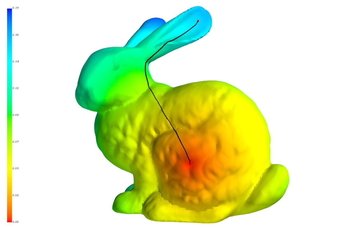
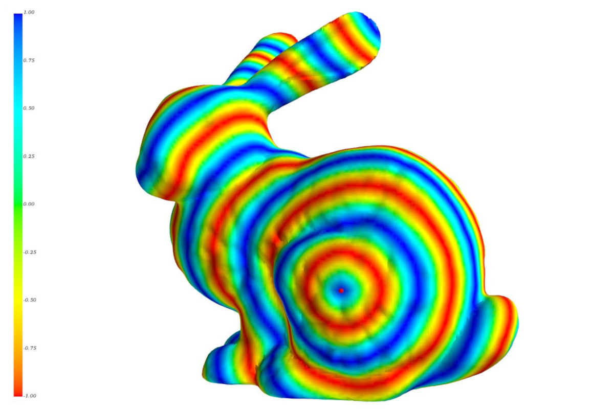
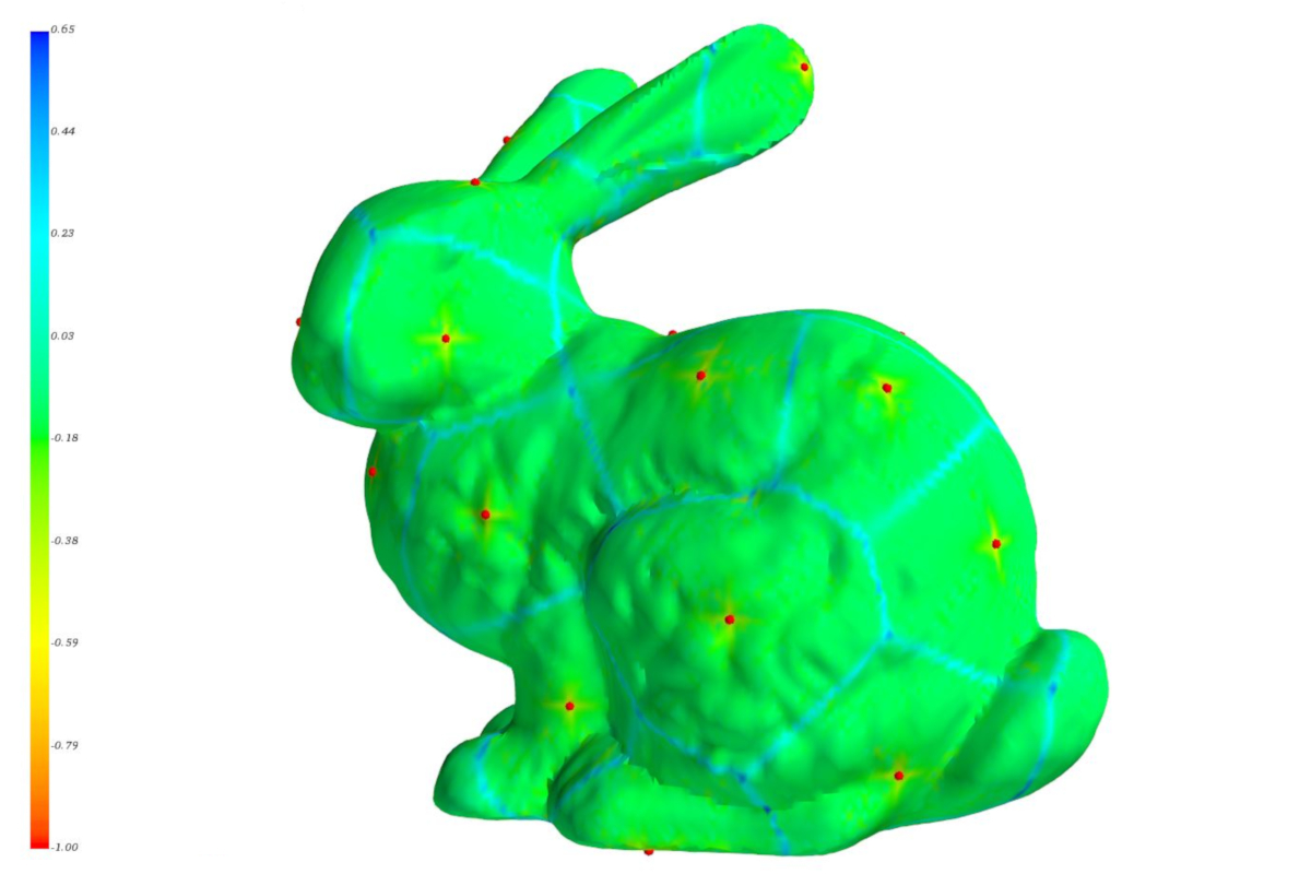
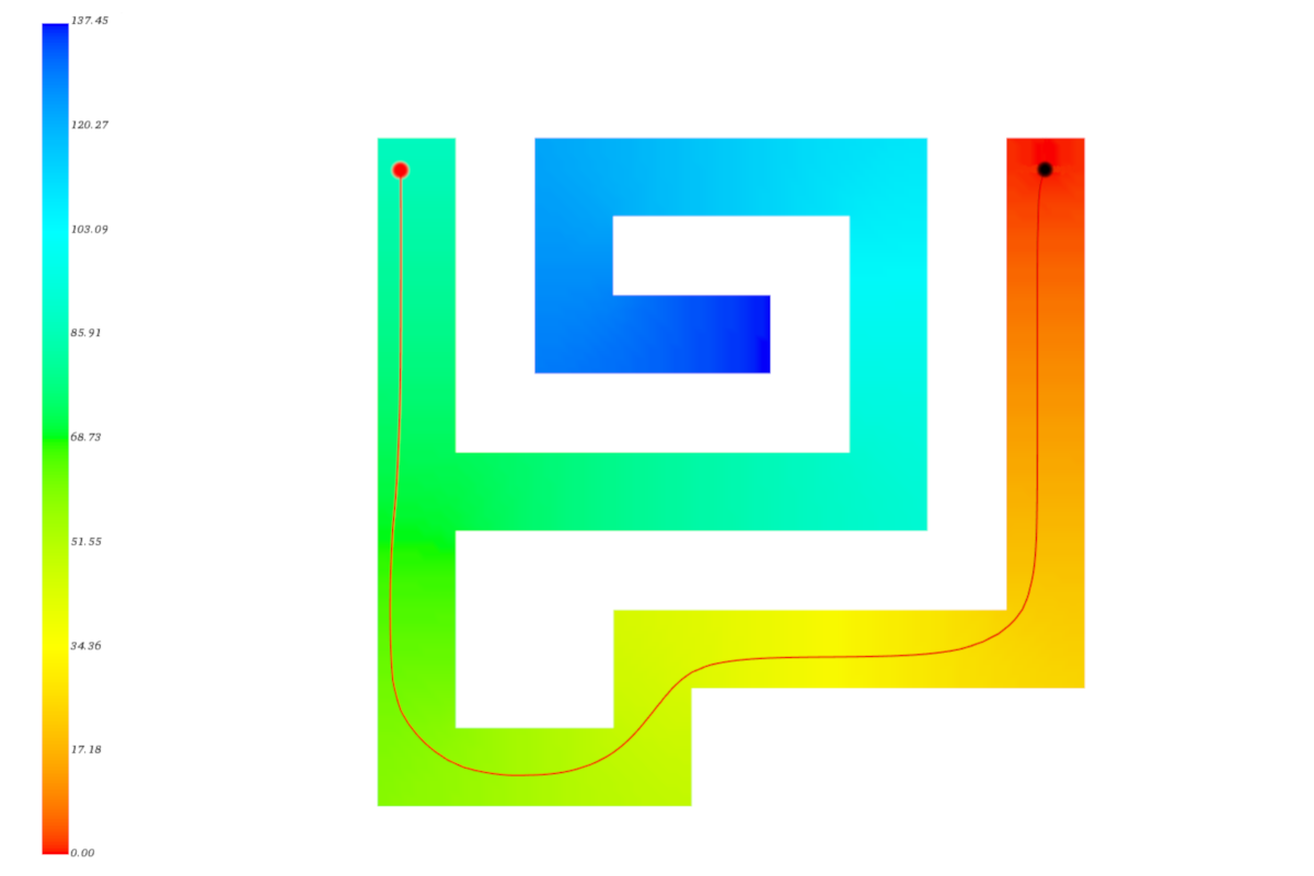
Different algorithms are implemented and compared to extract the shortest path between two points on a curved surface. A color map visualizes the geodetic distances to a freely chosen starting point on the surface of the model. The path to one or more selected points is extracted and the geometry data is made available for further use. [Source, 3D model, Stanford Bunny: Stanford University Computer Graphics Laboratory]
PROJECT DESCRIPTION
ACTIVITY SUPPLIED
- Software development
- Calculation
- Implementation
- Visualization
TOOLS USED
- Python, programming language
- C++, programming language
ALGORITHMS
- Heat Method
- Fast Marching Method
CUSTOMER
In-house development
INDUSTRY
- CAM, tool paths
- Robotics, path planning
- Navigation, geoinformation systems
- Electrical engineering, circuit diagrams